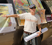
Ranie Lynds began managing the WSGS Energy and Minerals Resources Division in late 2017. Ranie has a B.S.
in geology and an M.S. in geophysics from Stanford University and a Ph.D. from the University of
Wyoming where she specialized in fluvial sedimentology. Ranie has worked on coal bed natural gas drill rigs in
Colorado’s San Juan Basin, dabbled in Utah’s uranium industry, and spent several years studying
geologic carbon sequestration in Wyoming’s basins.
Since joining the WSGS in 2012, she has focused
primarily on oil and gas research, delving into the details of not-so-well documented hydrocarbon
systems throughout the state and participating heavily in the WSGS’ STATEMAP program. Ranie spends
most of her free time trail running, mountain biking, and resurrecting some of Laramie’s historic
homes.
- ►Selected Publications
-
Lynds, R.M., and Xie, X., 2019, Detrital zircon geochronology of Upper Cretaceous to Paleocene sandstones from south-central Wyoming: evidence for middle Campanian Laramide deformation: Tectonics, v. 38.
Toner, R.N., Lynds, R.M., and Stafford, J.E., 2019, Oil and gas map of Wyoming: Wyoming State Geological Survey Map Series 104, scale 1:500,000.
Lynds, R.M., Pisel, J.R., Hoppes, K.L., Taboga, K.G., Wittke, S.J., and Kehoe, K.S., 2019, Preliminary geologic map of the Garden Gulch 7.5’ quadrangle, Carbon County, Wyoming: Wyoming State Geological Survey Open File Report 2019-3, 25 p., scale 1:24,000.
Lynds, R.M., and Slattery, J.S., 2017, Correlation of the Upper Cretaceous strata of Wyoming: Wyoming State Geological Survey Open File Report 2017-3.
Lynds, R.M., and Wrage, J.M., 2017, Preliminary geologic map of the Fort Steele SW 7.5’ quadrangle, Carbon County, Wyoming: Wyoming State Geological Survey Open File Report 2017-5, 25 p., scale 1:24,000.
Lynds, R.M., and Lichtner, D.T., 2016, Stratigraphy and hydrocarbon potential of the Fort Union and Lance formations in the Great Divide and Washakie basins, south-central Wyoming: Wyoming State Geological Survey Report of Investigations 73, 70 p., 2 pls.
Lynds, R.M., Toner, R.N., Freye, A.M., Sutherland, W.M., and Loveland, A.M., 2016, Preliminary geologic map of the Ervay Basin SW 7.5’ quadrangle, Natrona County, Wyoming: Wyoming State Geological Survey Open File Report 2016-4, 31 p., scale 1:24,000.
Toner, R.N., Lynds, R.M., Freye, A.M., and Sutherland, W.M., 2016, Preliminary geologic map of the Ervay Basin 7.5’ quadrangle, Natrona County, Wyoming: Wyoming State Geological Survey Open File Report 2016-3, scale 1:24,000.
Lynds, R.M., Palkovic, M.J., Carroll, C.J., and Ratigan, D.R., 2015, Preliminary geologic map of the Shamrock Hills 7.5’ quadrangle, Carbon County, Wyoming: Wyoming State Geological Survey Open File Report 15-6, scale 1:24,000.
Carroll, C.J., Lynds, R.M., Ratigan, D.R., and Palkovic., M.J., 2015, Report on the preliminary geologic maps of the Shamrock Hills and Rawlins Peak SW quadrangles, Carbon County, Wyoming: Wyoming State Geological Survey Open File Report 15-8, 33 p.
Lynds, R.M., Mohrig, D, Hajek, E.A., and Heller, P.L., 2014, Paleoslope reconstruction in sandy suspended-load dominant rivers: Journal of Sedimentary Research, v. 84, p. 825–836.
Lynds, R.M., Campbell-Stone, E.A., and Toner, R.N., 2014, Preliminary geologic map of the North Ridge 7.5’ quadrangle, Johnson County, Wyoming: Wyoming State Geological Survey Open File Report 14-3, scale 1:24,000.
Carnes, J.C., Lynds, R.M., Gregory, R.W., and Ver Ploeg, A.J., 2013, Preliminary geologic map of the Dale Creek 7.5’ quadrangle, Albany County, Wyoming: Wyoming State Geological Survey Open File Report 13-2, scale 1:24,000.
Lynds, R.M., 2013, Geologic storage of carbon dioxide (CO2) in the Laramide basins of Wyoming: Wyoming State Geological Survey Technical Memorandum 3, 200 p.
Becker, T.P., and Lynds, R.M., 2012, A geologic deconstruction of one of the world’s largest natural accumulations of CO2: the stratigraphy, structure, and hydraulic connectivity within the Paleozoic of the Moxa Arch, southwestern Wyoming, U.S.A: AAPG Bulletin, v. 96, no. 9, p. 1,643–1,664.
Lynds, R., Campbell-Stone, E., Becker, T.P., and Frost, C.D., 2010, Stratigraphic evaluation of reservoir and seal in a natural CO2 field: Lower Paleozoic, Moxa Arch, southwest Wyoming: Rocky Mountain Geology, v. 45, no. 2, p. 113–132.
Lynds, R.M., and Hajek, E.A., 2006, Conceptual model for predicting mudstone dimensions in sandy braided-river reservoirs: AAPG Bulletin, v. 90, p. 1,273–1,288.
|